The Enchanting Beauty of Littleborough and its Pennine Villages

The Enchanting Beauty of Littleborough and its Pennine Villages

The Enchanting Beauty of Littleborough:

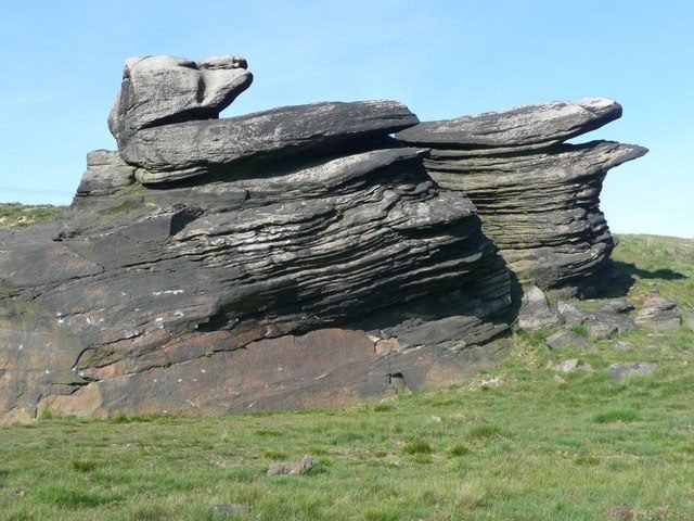
Nestled beneath the undulating hills and sweeping moorlands on the edge of the Pennines, lies the captivating landscape of Littleborough and its surrounding Pennine villages.

This picturesque township, within the Rochdale Borough, is a haven for nature enthusiasts, history buffs, and those seeking an idyllic escape. With tranquil waterways, rolling hills, and a rich tapestry of heritage, Littleborough offers a world of adventure and exploration.

Enchanting Beauty of Littleborough

Littleborough: A Glimpse of Tranquility

At the heart of this remarkable area lies Littleborough, a charming village that beckons with its serene ambience. Set against the backdrop of lush hillsides and sprawling moorlands, Littleborough offers a respite from the bustling city life. Here, you’ll find a retreat where time slows down, and nature’s embrace is ever-present.

For those interested in getting out and about, there are plenty of walks in the local countryside. Whatever your ability, there is something for everyone.

The Littleborough Boundary Walk is an adventurous trek that takes you through diverse terrain, ranging from steep inclines to sharp descents. The trail, which stretches for eighteen miles, is not for the faint-hearted and is best suited for experienced hikers.

It is advisable to wear strong boots and comfortable clothing to ensure your safety, especially as the weather can change unexpectedly. As you embark on this journey, be prepared to witness breathtaking views and immerse yourself in the beauty of nature.

If you fancy tackling the route, you will find it marked on the OS Explorer Map OL21. If you have older OS Maps then you will find the route on OS Maps SD81/91 and SD82/92.

What is the Littleborough Boundary Walk?

The walk closely follows the outline of the old Littleborough Urban District Council. This existed before Greater Manchester. The route isn’t exact due to poor terrain and a reservoir.

However, it still provides a great sense of history. Since it’s a boundary, there is no distinct starting point. Yet, most guides suggest starting from Hollingworth Lake.

This is an ideal spot to begin and end the walk. There is ample parking and refreshment options. Both are available at both the start and finish points.

Enchanting Beauty of Littleborough - Hollingworth lake

The route has existed since the 1970s, being instituted by the Littleborough Civic Trust Footpaths Group. You can find more information about the work of the Civic Trust here. You can obtain a copy of the guide to the Walk (Leaflet No.8) from the Littleborough Historical & Archaeological Society (details here) or from Littleborough Bookshop (details here). The guide costs only a modest amount of £1. Note that the leaflet is currently out of print but the bookshop and other local venues still have some copies available.

Embracing Nature’s Bounty

Nature enthusiasts will find solace in the rolling hills and verdant countryside that characterizes the Pennines. As you venture through the Pennine villages, including Milnrow, Newhey, and Wardle, you’ll encounter a landscape that invites exploration.

Drowned village of Watergrove

Unveiling the Past: Littleborough’s Rich Heritage

The history of Littleborough and its Pennine villages unfolds like a captivating tale. The rushbearing weekend in Littleborough stands as a testament to the area’s enduring traditions.

Pennine Villages: A Portal to the Past

Delve deeper into the heritage of the region by immersing yourself in the Pennine villages. These charming settlements hold echoes of times long past, where stories are etched into cobblestone streets and historic buildings.

Embracing Adventure and Serenity

For those with a penchant for outdoor activities, Littleborough and the Pennines offer a playground of possibilities. Whether it’s walking, cycling, or horse riding, the rolling hills and pristine waterways provide the perfect backdrop for your escapades.

Serenity by the Waterways

The gentle lapping of tranquil waterways against the shores adds an element of serenity to Littleborough’s charm. Canals and reservoirs offer a haven for those who find solace in the embrace of still waters.

Rochdale Canal, Smithy Bridge - Enchanting Beauty of Littleborough

Rochdale Canal, Smithy Bridge

Planning Your Littleborough Escape

As you plan your visit to Littleborough and its Pennine villages, let the keywords guide your journey. Whether you’re captivated by history, eager for adventure, or seeking moments of serenity, this remarkable area promises an unforgettable experience. Explore the pages of Littleborough Lakeside for more insights and details to enhance your visit.

Conclusion

Littleborough and its Pennine villages stand as a testament to the harmonious blend of nature’s beauty and historical charm. With a landscape that whispers tales of the past and beckons with the promise of adventure, this captivating area invites you to uncover its secrets. As you explore Littleborough’s enchanting vistas and embrace the warmth of its heritage, you’ll find yourself immersed in a journey that transcends time.

Drowned Village of Watergrove

Drowned Village of Watergrove

History of the drowned village of Watergrove:

The drowned village of Watergrove lies nestled beneath a horseshoe ridge of hills in Wardle, Lancashire lay the village of Watergrove. This picturesque village, largely a Victorian creation, was surrounded by farms dating back to the 1700s. Furthermore, it was a wild and charming spot, adorned with sheep-grazed heather and whinberry moorlands. The local farms and houses were built with stone quarried from the nearby hills, while coal mining was also a significant industry in the area.

However, in the 1930s, the fate of Watergrove took a drastic turn. The decision was made to create a large reservoir to supply drinking water to Rochdale. As a result, not only was the village destined to disappear beneath the new lake, but the thirty surrounding farms above the waterline were also marked for demolition.

Drowned village of Watergrove

Watergrove Village, constructed in the 1840s, grew steadily over two decades, reaching a peak population of 300 residents. The village was supported by three mills: Watergrove Mill, Roads Mill, and Alder Bank. While the village boasted a Methodist church and a public house called The Orchard, it lacked a school, forcing the children to walk to the nearby Wardle for their education.

Watergrove Mill, a main employer in the village, was originally built in 1841 for weaving woollen cloth. Under the ownership of Mary Clayton, it expanded ten years later to produce cotton goods and employed 40 staff. By 1871, the mill had evolved into a large steam-powered factory.

The village is doomed:

The construction of the reservoir in the 1930s was a monumental undertaking that had a profound impact on the community. Not only did it provide much-needed employment during a time of high unemployment, but it also transformed the landscape forever.

With a compulsory purchase order granted, 500 men were employed to build the reservoir, using equipment from Roads Mill, which was relocated to Wicken Hall Mill in Lower Ogden. Watergrove Mill was also commandeered for the project, highlighting the scale of the construction.

However, over the next few years, the village was forever changed as most of the surrounding farms were destroyed, some even subjected to dynamiting, leaving behind only ruins. The village buildings themselves were also demolished to make way for the reservoir, which was officially opened on April 6th, 1938.

The construction of the reservoir was a monumental task, requiring a great deal of hard work, sacrifice, and dedication from those involved. The photographs showcasing the construction of the reservoir offer a glimpse into the sheer scale of the project and the transformation of the landscape.

Impact of the Reservoir on the local area:

It’s hard to imagine the impact that the construction of the reservoir had on the community. The loss of the surrounding farms and village buildings was a profoundly emotional experience for those who lived there. However, the finished reservoir provided a vital resource for the community, ensuring they had access to clean drinking water for years to come.

In conclusion, the construction of the reservoir was a feat of engineering that transformed the landscape of the community forever. It provided much-needed employment during a time of high unemployment while also ensuring access to clean drinking water for the community. The photographs showcasing the construction of the reservoir are a testament to the hard work, sacrifice, and dedication of those involved in the project.

Drowned village of Watergrove - rescued parts of the drowned village structures.

Remnants of past lives:

Watergrove’s drowned village has remnants from 1646. Stones from the village and surrounding farms are preserved in the Wave Wall on Watergrove Reservoir banks. Mills once active now lie submerged. During dry weather, foundations re-emerge, hinting at their former existence.

Ramsden Road leads to ruins, each with its name on signs. Littletown Farm is first, followed by Steward Barn. Thimble Hall, a notable property, is located just off Ramsden Road. The landscape reveals ruined farms, like Lower Slack Barn and Alder Bank House. Old quarries that extracted stone for the village are also visible.

A single tenant farmer manages a large flock of sheep in the modern-day landscape. Efforts are being made to restore a more diverse ecosystem. Local rangers have successfully conducted heather regeneration experiments. The reservoir’s immediate surroundings have a rich array of wildflowers during summer.

Visiting the area:

Watergrove Reservoir and its drowned village offer a fascinating glimpse into Lancashire’s past. Today, visitors can explore the ruins, appreciate the preserved date stones, and marvel at the transformation of the landscape. The reservoir stands as a testament to the ever-changing nature of our world, where progress and the need for resources can reshape communities and landscapes.

Car Parking:

For those planning a visit, the site is open to the public, with a free car park available at the reservoir. 

Location: Ramsden Rd, Wardle, Rochdale OL12 9NH.

There is a separate disabled car park, accessed with a key. Contact: 01706 881 049.

Public transport:

The 456 Lakeline bus drops off at Chapel, in Wardle village.

Things to do:

  1. Bird-watching – Key access to the bird hide is only available by contacting 01706 881 049.
  2. Walking – check out this map for details of circular walks around the reservoir.
  3. Bridleways – Mary Towneley Loop is part of the Pennine Bridleway. See the map for details.
  4. Sailing – The West Pennine Windsurfing Club has lots of activities on offer, from windsurfing and paddleboarding to kayaking and canoeing.

References:

Discover Littleborough and the Pennine Villages

Discover Littleborough and the Pennine Villages

Discover Littleborough and the Pennine Villages

Discover Littleborough and the Pennine Villages

An area nestled in the Pennines, situated just outside Rochdale. Known for its picturesque scenery and rich history, Littleborough and the Pennine Villages is a popular destination for those looking to explore the great outdoors.

A Brief History

The area has a rich history dating back to the Roman period, with evidence of Roman activity found throughout the region. During the Industrial Revolution, the area saw a boom in textile production, with mills being built throughout the valley.

The Villages

The area is composed of several villages, each with its own unique charm and character. These include:

Littleborough

Littleborough is the largest village in the area, and is home to a variety of shops, restaurants, and cafés. The village also boasts a number of historic buildings, including Littleborough Coach House and the Shore Hall.

Walsden

Walsden is a small village situated in a picturesque valley. The village is home to a number of historic buildings, including St. Peter’s Church and the Hollins Mill.

Smithy Bridge

Smithy Bridge is a small village situated on the Rochdale Canal. The village is home to historic Clegg Hall and the popular tourist attraction of Hollingworth Lake.

Summit

Summit is a small village situated on the outskirts of Littleborough. The village is home to a number of shops and restaurants, as well as a historic church.

Wardle

Historically a part of Lancashire, Wardle and its surroundings have provided archaeological evidence of Mesolithic activity in the area. The name Wardle is said to be derived from “Ward Hill”, implying “fortified place”. Places to visit include Wardle Village Church and Watergrove Reservoir, with its drowned village! There is a free car park at the reservoir, though the approach road is very uneven, being an old cobbled road, so be sure to drive very slowly up to the car park. It is definitely worth it though as there are pleasant walks around the reservoir and the surrounding hills.

Things to See and Do

Littleborough and the Pennine Villages offer a wealth of activities for visitors to enjoy. Here are just a few things to see and do:

Hiking and Walking

The area is a hiker’s paradise, with a variety of trails and paths to explore. From the Rochdale Canal towpath to the Pennine Way, there is something for hikers of all abilities. There is the Pennine Way and Blackstone Edge. Furthermore, you have plenty of walks around local reservoirs, often with spectacular views over the surrounding hills and valleys.

Cultural Attractions

The area is home to a number of cultural attractions, including the Littleborough Coach House and the Littleborough Arts Festival. Visitors can also explore the area’s rich history at the Littleborough Heritage Centre.

Food and Drink

Littleborough and the Pennine Villages is home to a variety of restaurants, cafés, and pubs. Visitors can sample local delicacies such as Lancashire Hotpot and black pudding, and enjoy a pint of real ale at one of the many pubs in the area.

Getting Here

Littleborough and the Pennine Villages are easily accessible by car or public transport. The area is situated just off the M62, and is well-connected by rail and bus services.

In Conclusion

The area is part of the South Pennines, with plenty of places just waiting to be discovered. Whether your interest is in history, wildlife, or you simply wish to explore nature, there is something for all ages and abilities in this beautiful area. 

Be sure to check out some of our other posts, such as the one on Hare Hill House in Littleborough or the one about Edwin Waugh, a Lancashire Dialect Poet.

Share the Post:


Related Posts

Join Our Newsletter